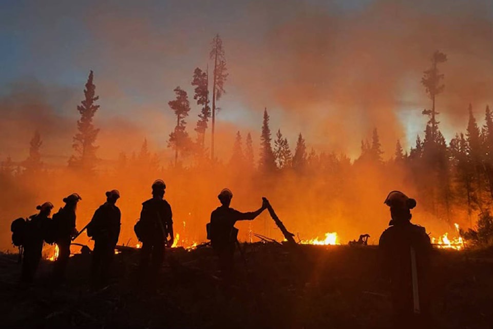
The BC Wildfire Service provided a general update on the current wildfires within the Cariboo Fire Centre for Friday, July 16, 2021.
There are currently 56 active wildfires within the Cariboo Fire Centre.
The fire danger rating in the Cariboo is currently mostly high across the centre, with some pockets of extreme.
Wildfires of Note
There are nine Wildfires of Note within the Cariboo Fire Centre. Three fires are now being managed by an Incident Management Team (Succour Lake, Flat Lake, and S of Canim Lake).
The wildfire north of Big Stick Lake is estimated to have grown to 5,850 hectares in size. The BCWS said the wildfire was fairly calm Thursday with the cooler temperatures and higher relative humidity on site. The fire has impacted Highway 20. As of Friday, Highway 20 near Kleena Kleene is open, with Dawson Road Maintenance piloting members of the public through when it is safe to do so. Crews are working today to keep Highway 20 protected. Telus fibre optic lines in the area have not been compromised.
An Evacuation Order is in effect for the Big Stick wildfire area. This order replaces the Evacuation Alert issued by the Cariboo Regional District on July 10.
An Evacuation Alert issued by the Cariboo Regional District has been expanded and remains in effect for the Big Stick wildfire area.
The Hotnarko Creek wildfire is estimated at 1,500 hectares. The BCWS said the wildfire was fairly calm Thursday with cooler temperatures and higher relative humidity. Personnel and equipment are working today to establish containment lines along Highway 20. Highway 20 is reopened from 3 a.m. to 11 a.m. with pilot cars escorting the public through when it is safe to do so.
The Purdy Lake wildfire is estimated to be 7,800 hectares in size. The BCWS said personnel and heavy equipment are working to make improvements to existing roads and using natural features to create defendable fire guards. They are also working to establish egress routes and safety zones. BC Parks have been engaged regarding suppression in the Kluskoil park.
An Evacuation Alert has been issued by the Cariboo Regional District. This Evacuation Alert area now borders the Evacuation Alert issued by the Regional District of Bulkley-Nechako for the Grizzly Lake wildfire in the Prince George Fire Centre.
The McKinley Lake wildfire is 1,834 hectares in size. There were optimal conditions on site Friday, including scattered precipitation, cooler temperatures, and higher relative humidity have allowed crews to make good progress. Little to no fire growth was expected Friday.
An Evacuation Alert issued by the Cariboo Regional District for Crooked Lake remains in effect.
The Chasm wildfire is 374 hectares. Personnel and equipment are working to contain escapes on the southwest corner. Contingency guards have been established and crews are continuing to establish guards around the fire.
An Evacuation Alert has been issued by the Thompson-Nicola Regional District.
The Young Lake wildfire is estimated at 680 hectares. This fire is being managed by the Sparks Lake Incident Management Team.
Churn Creek Protected Area is no longer a Wildfire of Note.
Summary of other wildfires
Below is a summary of some of the active fires, by zone, as of July 16.
Quesnel Fire Zone
There are ten active wildfires burning in this zone.
· C11552 – The wildfire burning south of Kluskus Lake is 28 hectares in size and is now classified as being held. BCWS personnel are continuing with fire suppression operations.
Central Cariboo Zone
There are three active wildfires burning in this zone.
· All three fires (C21722, C21747, and C21250) are now classified as under control.
100 Mile Fire Zone
The Incident Management Team is managing wildfires to the north of Highway 24 and east of Highway 97 within this zone. There are 32 active wildfires burning in this zone. All fires and reports of wildfires are continuing to be assessed and actioned in priority sequence. The most notable wildfires are:
South of Canim Lake
This wildfire is estimated at 1,651 hectares. Crews remained on site overnight to establish structure protection and to maintain a sprinkler line in the area. Personnel and heavy equipment are continuing to establish fire guards and contingency guards.
The Cariboo Regional District has upgraded the existing Evacuation Alert to an Evacuation Order on the south side of Canim Lake. The north side remains on an Evacuation Alert.
Succour Lake
The Succour Lake wildfire is estimated at 528 hectares. Crews have completed a hose lay around a large spot fire on the southeast flank and continue to suppress hot spots.
The Cariboo Regional District has expanded the existing evacuation alerts on both the north and south sides of Canim Lake.
Flat Lake
The Flat Lake wildfire is estimated at 10,000 hectares. Aggressive fire behaviour was observed yesterday evening. Crews remained on site throughout the evening to monitor the fire. Personnel and equipment are working to establish guards on the southeast flank of the fire today. Highway 97 has re-opened in both directions. The highway may be closed again on short notice.
At this time, the BC Wildfire Service has not implemented any backcountry closures. All trails and backroads that are not affected by Area Restriction Orders, Evacuation Orders, or are otherwise under municipal jurisdiction, remain open for public use. Members of the public must remain vigilant and act responsibly when recreating in the backcountry. Know before you go: check the local fire danger rating, download the BC Wildfire Service app and stay up to date with location-specific wildfire information.
Do you have a comment about this story? email:
editor@wltribune.com
Like us on Facebook and follow us on Twitter.