The risk of flooding in the South Cariboo is a very real possibility, with the snowpack still relatively near its peak level throughout the mid-Fraser basin.
Dave Campbell, British Columbia’s River Forecast Centre (RFC) spokesperson, says the problem is an increased snow pack this year combined with a "significant delay" in the onset of the melt.
"We're seeing a three- to four-week delay in the snow melt, on average. We also have high overall amounts of water stored in the snowpack within the [mid-Fraser] area."
All it will take now is sudden warm temperatures or excessive rainfall to shift the tide from a high snowpack level to flooding lakes, streams and rivers.
"We're in the elevated flow period and the weather is going to determine that [melt rate]."
For the South Cariboo watersheds, devices monitoring the snowpack collect data at Boss Mountain near Horsefly and at Mt. Timothy near Lac la Hache.
Boss Mountain has a real-time data link to the RFC for the area, so Campbell was able to provide recent levels as of May 26.
"[At Boss Mountain], we have been seeing steady melts throughout the week at about 10 millimetres per day. Currently, we are at about 70 per cent of the peak snowpack for the year [of about 600 mm]. It has melted down to about 460 mm."
As of mid-May, Mt. Timothy was still at a 97 mm depth, or 174 per cent of its peak snow level, while Boss Mountain was at 131 per cent of the peak level.
Campbell notes it is still "a lot of snow to melt off" during the next four to five weeks.
Forecasting flood danger is challenging in the South Cariboo; however, he explains the “per cent of normal” is skewed by the late melt, so is harder to interpret.
"Within the region, unfortunately, it is pretty sparse in terms of the amount of snowpack data that's available, and also in terms of real time river flow gauges."
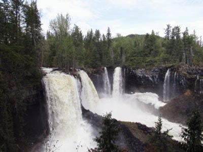
The rivers, lakes and streams are at a high rate of flow and Campbell cautions people to stay well back from the banks as they become unstable when at a high level and can easily collapse.
The communities in the south haven't experienced the same heavy rainfall that caused the significant flooding in Quesnel, Prince George, and Houston/Bulkley Valley areas, he explains.
Campbell notes that while there is an elevated risk due to the snowpack and delayed melt, he is not aware of specific flood risks within the South Cariboo area.
"I rely on and I work closely with the regional staff members who are on the ground more to get that kind of perspective. I'd be monitoring stream flow conditions and they might understand what that actually means in impacts on the ground."
The province's flood advisories and warnings are available at http://bcrfc.env.gov.bc.ca/.
To review the RFC's regular updates on specific levels at monitoring stations, follow the links for water-supply and drought advisories.
Martens follow-up
Wolfgang Martens says he is watching Canim Lake rise at his resort, where lake levels are only an inch or two lower and 10 feet back from their sandbagged cabin on May 27.
"Since the ice melted on April 25, the lake has risen six feet," he says.