Backroad access has delayed the need to evacuate areas of a First Nations community near 100 Mile House due to rising flood waters.
Tsq’escenemc (Canim Lake Band) Chief Helen Henderson said a logistics meeting on the main reserve road, Tsq’Escen Road, will be taking place Friday morning (May 1) with the Ministry of Transportation and Infrastructure (MOTI).
She said more sandbags were put down Thursday, April 30.
“The main road into our main reserve is being assessed,” Henderson said. “ There are parts of the road where the main flow runs that is giving away. For this reason, logistics is meeting with MOTI.”
Since April 30, Henderson said they have issued an evacuation alert for residents on the north side.
“At this time, there is still access through the backroad which can delay the need to evacuate,” she said.
Read More: Canim Lake Band Impacted by rising flood waters
DriveBC lists the Tsq’Escen Road as closed to all traffic except emergency vehicles, and said the next update will be 3 p.m May 1.
Henderson said the road is stable for now and they have been advised that no heavy equipment will be used at this time.
“Rest assured, our emergency operations centre has been working tirelessly to mitigate further flooding issues,” she said.
Read More: Update: Spring flooding wreaking havoc on Cariboo Chilcotin roads
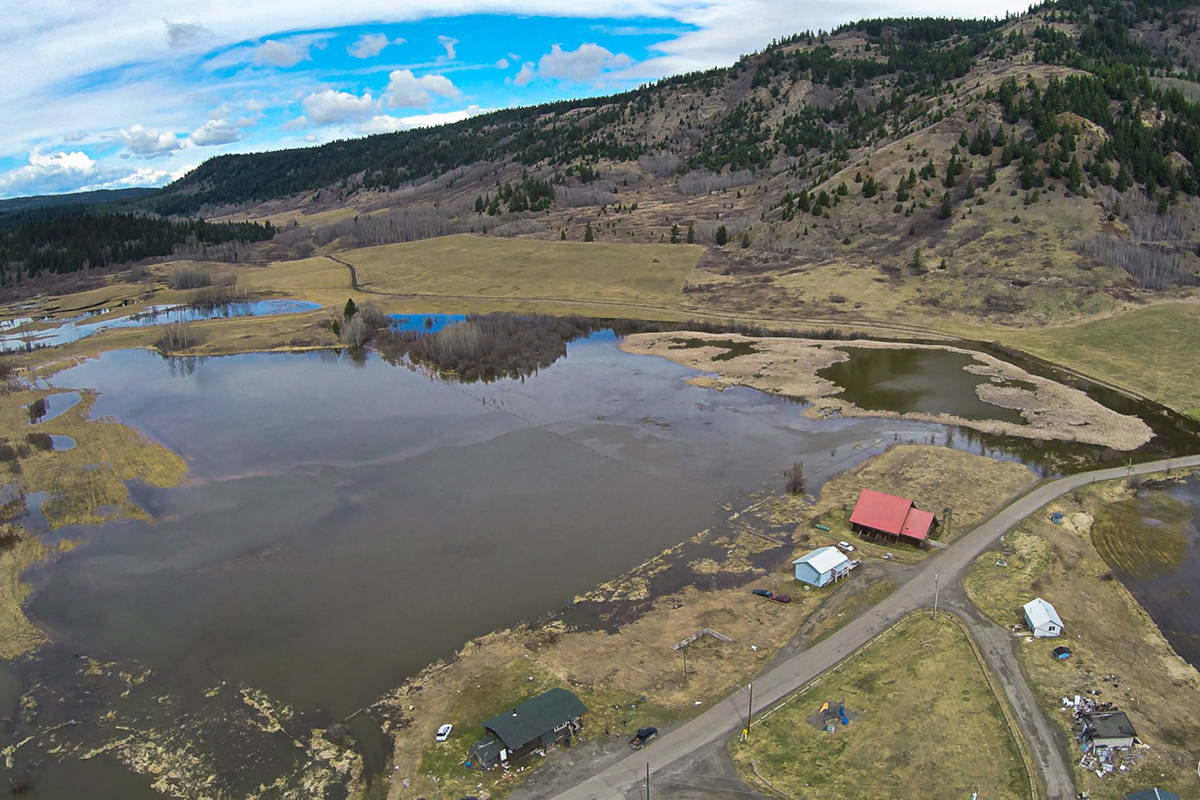
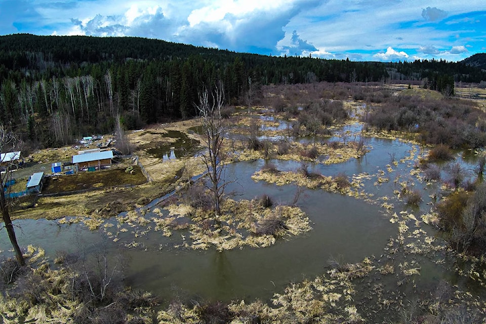
Owner of Canim Lake General Store, Robert Brunet has lived in the area for the last 20 years. He has been doing aerial photography of the area for a number of years.
“I was a bit shocked to see how much water there actually was especially on the reserve part,” he said. “I’ve the seen the water level on Canim Lake quite high before but this is the highest that I’ve ever seen it, but yet it’s still not at a dangerous level so all the properties at least on the south end of the lake seem to be quite fine.”
Another area Brunet took aerial photos and footage of was the Bridge Creek-Houseman Road area in which an evacuation alert remains in place as of May 1.
“It’s quite bad there,” he said. “There’s water right up to some of the properties, right up to the foundation, so it looks pretty dangerous there. Hopefully there won’t be much more water and no more rain for a few days.”
www.facebook.com